L.I. How Did We Get Here? Transportation
Transportation
A Timeline of Transportation on Long Island
Long Island boasts many exceptional accomplishments in transportation, from building the world’s first limited-access highway, to launching the first transatlantic flight, to the approximately 10,000 Grumman workers building the Lunar Module that allowed the Apollo astronauts to land on the Moon.
The region is also recognized as one of the earliest auto-dependent suburbs in America. Parkways, which were intended to allow easy access to parks and beaches for middle-class New York City residents, became commuter routes that promoted sprawl development, leading to induced-demand traffic congestion. The decision to build the Long Island Expressway without including any public transportation infrastructure increased the trend toward low-density development, exacerbating reliance on private automobile ownership.
Dependence on automobiles is a hallmark of suburban life on Long Island, but long-awaited improvements to the Island’s rail transportation system are now being implemented. Improvements to the Long Island Rail Road are spurring transit-oriented developments near train stations, providing transportation options.
To bring communities together to address today’s transportation challenges, it is beneficial to consider the question, Long Island: How Did We Get Here?
This 12-minute video presents highlights from the timeline of transportation infrastructure on Long Island, including milestones and historic firsts, and shows how past decisions shape our transportation options today.
TRANSPORTATION ON LONG ISLAND — TIMELINE OF EVENTS
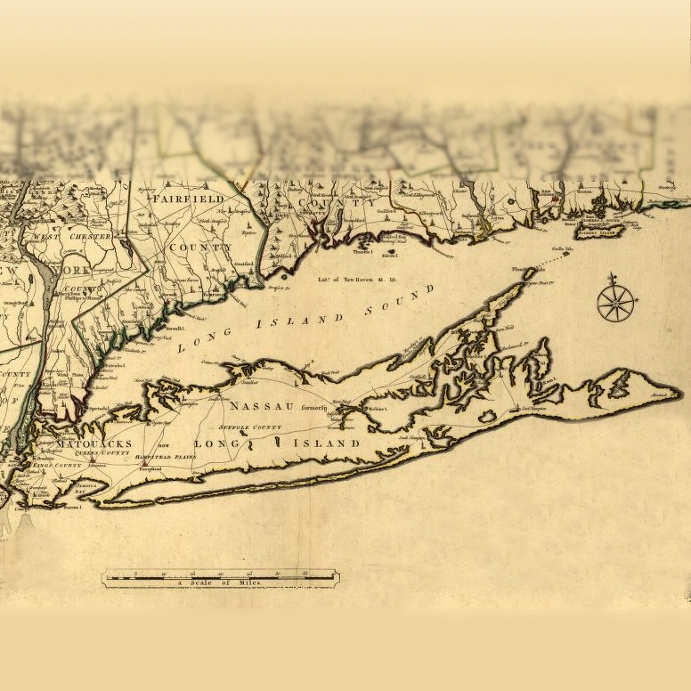
1703 — First "Highways"
In 1703, the New York General Assembly appointed highway commissioners in each of Long Island’s three counties: King’s County (now Brooklyn); Queen’s County (now Queens and Nassau); and Suffolk County. The highway commissioners were responsible for the building and maintenance of roads “four rods wide” (66 feet). These roads were unpaved, only packed to hardness by foot, hoof, and cart traffic.
The three major “highways” of colonial Long Island, North Country Road, Middle Country Road, and South Country Road, were laid out and constructed within thirty years after the highway commissioners first planned their routes. These roads still exist in many areas and have become part of today’s New York State Route 25A, New York State Route 25, and Montauk Highway.
History of Horseblock and Middle Country Roads
More Details +
The General Assembly appointed highway commissioners who established east-west dirt roads significant parts of which evolved into today’s 25A, Jericho Turnpike and Montauk Highway.
In Long Island’s early history, the only transportation options were narrow footpaths and waterways. Most paths were no more than two or three feet wide.
Through use and clearing, early European settlers widened the most traveled paths into cartways that could accommodate horse- or ox-drawn carts.
In 1703, the New York General Assembly appointed highway commissioners in each of the three counties then on Long Island: King’s County (now Brooklyn), Queen’s County (now Queens and Nassau), and Suffolk County to direct the building and maintenance of roads “four rods wide” (66 feet). These roads were unpaved, only packed to hardness by foot, horse, and cart traffic. Over time, drainage ditches were dug, and logs or wooden planks were added as road surfaces to make them more usable in wet weather.
The three major ‘highways’ of colonial Long Island — North Country Road, Middle Country Road, and South Country Road — were laid out and constructed within thirty years after the highway commissions first planned their routes. These routes still exist in many places and have been made into parts of today’s Route 25A; Route 25 or Jericho Turnpike; and Montauk Highway.
1792 — Montauk Point Lighthouse Commissioned
Authorized by the Second United States Congress and commissioned by George Washington in 1792, Montauk Point Lighthouse was the first lighthouse in New York State. It was intended to facilitate shipping to New York Harbor, as ships approaching from the east needed a beacon to safely guide them south of Long Island.
About the Montauk Point Lighthouse - Montauk Historical Society
1796 — Montauk Point Lighthouse Constructed
Construction began on the Lighthouse on June 7, 1796, and was completed on November 5, 1796. The Montauk Point Lighthouse tower is 110 feet 6 inches high and was one of the first federal public works projects in the United States.
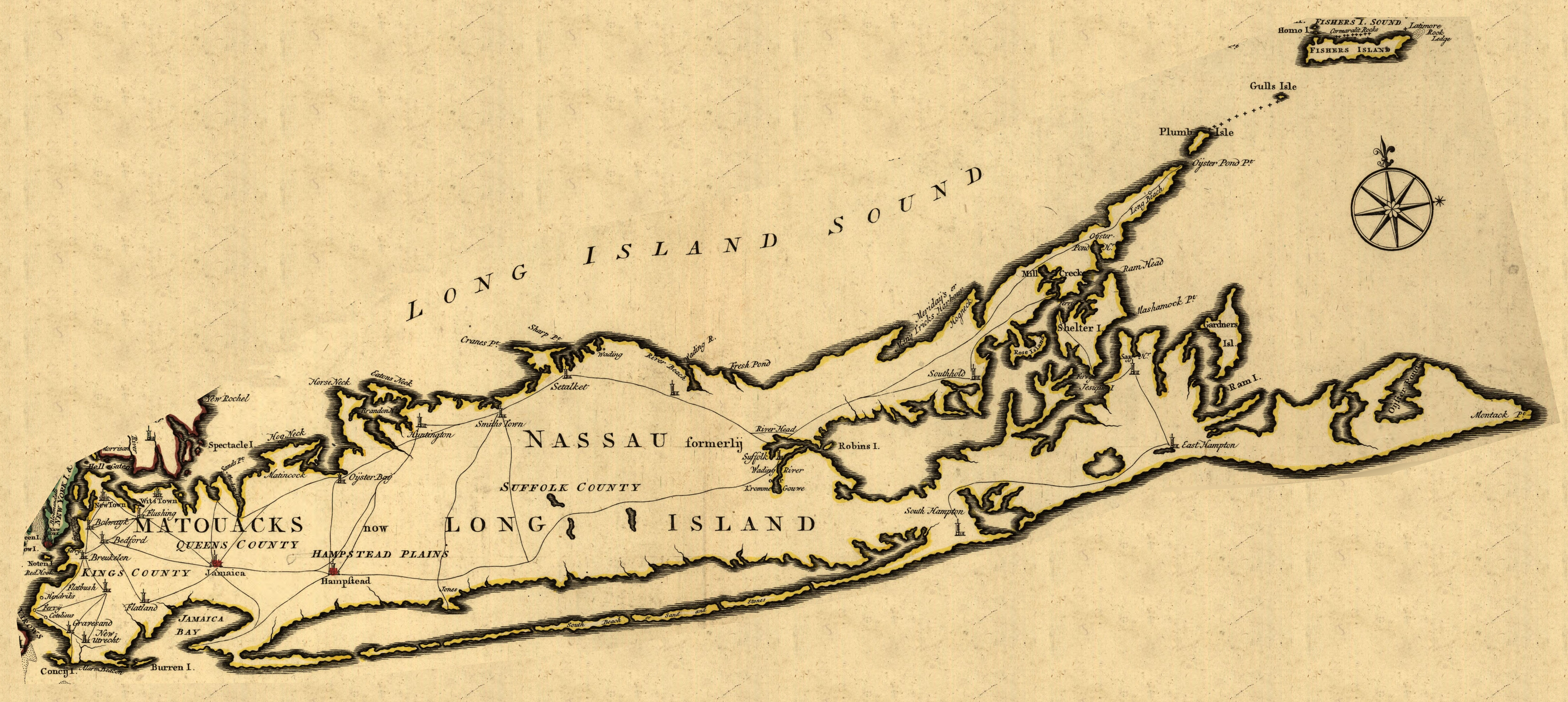
1834 — Long Island Rail Road Chartered
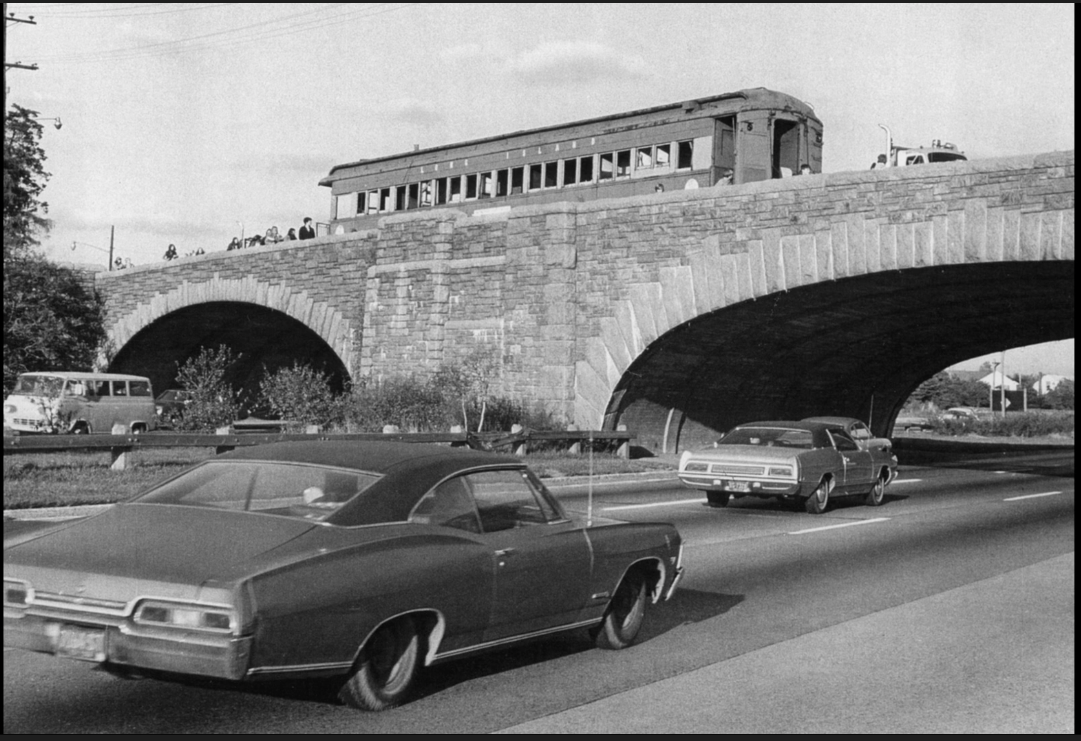
The Long Island Rail Road (LIRR) was granted a charter by the New York State Legislature in 1834. It was not originally intended to serve Long Island. The main purpose of the railway was to carry passengers between New York City and Boston, with a ferry ride between Greenport and Stonington, Connecticut, to connect with a railroad that continued to Boston. The terrain of southern Connecticut was considered impractical for building rail at the time. Land for a right-of-way down the center of Long Island was relatively flat, had no major rivers to traverse, and was sparsely settled; therefore, it had few grade crossings and was inexpensive to construct. The track reached Hicksville in 1837. Passengers from Long Island’s more populated communities on the north and south shores had to take long stagecoach rides to reach the stations.
Long Island Railroad History - Long Island Historical Journal
1844 — LIRR Main Line Completed
Service to Greenport began in 1844. A steamboat owned by the LIRR ferried passengers across the Long Island Sound, where they connected with rail service to Boston. The LIRR became the primary passenger and mail route between the two cities. In 1848, the completion of the New York and New Haven Railroad through southern Connecticut provided a faster, fully overland route between New York City and Boston. Unable to compete with the New York and New Haven Railroad, the LIRR was forced to begin serving Long Island. It expanded to the more populous north and south shores by building new branches, eventually reaching Huntington and consolidating with two other local railroad companies to gain their existing tracks. As the network grew, the LIRR began promoting Long Island as a resort destination to spur ridership.
More Details +
Service to Greenport began in 1844. There, a steamboat owned by the LIRR took passengers across the Long Island Sound to continue by rail to Boston. The combined trip cut 5 hours off the shortest land route between New York City and Boston at the time. There was competition with other rail and steamship routes, but the LIRR became the primary passenger and mail route between the two cities.
In 1848, the completion of the New York and New Haven Railroad through southern Connecticut provided a quicker, fully overland route between New York City and Boston. The LIRR’s profits collapsed.
The LIRR was forced to begin serving Long Island. It expanded to the more populous north and south shores by building a new branch that eventually reached Huntington and consolidating with two other local railroad companies. To increase ridership, the LIRR began to promote Long Island as a resort destination. It provided excursion service to shorefront communities where resort hotels had been built.
Long Island Railroad History - Long Island Historical Journal
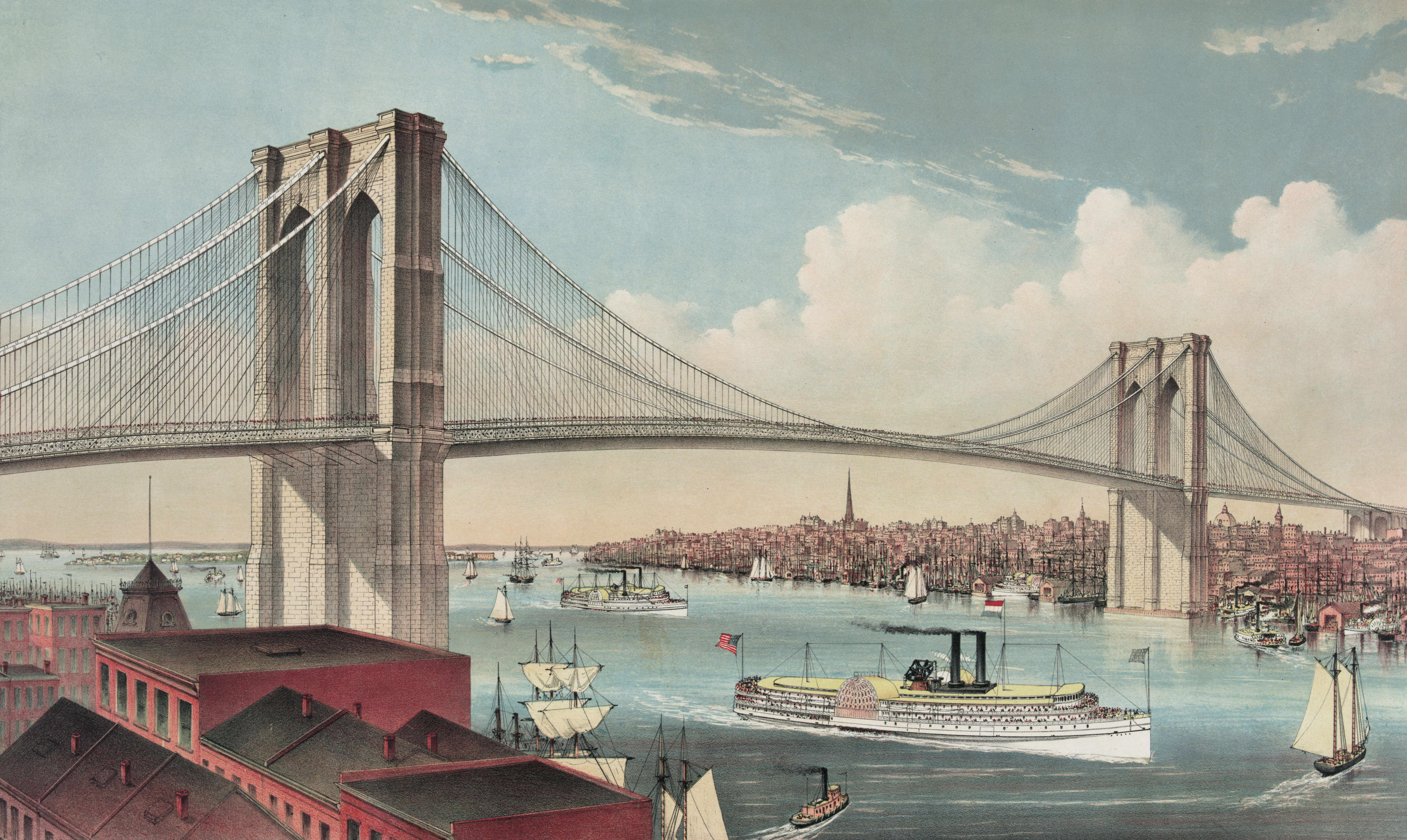
1883 — Brooklyn Bridge Completed
Construction began on the Brooklyn Bridge in 1869 and was completed in 1883. Designed by John Roebling, the bridge was the longest suspension span in the world at the time. It provided the first direct connection to Long Island without a boat.
Brooklyn Bridge History - history.com
About the Brooklyn Bridge - NYC Department of Transportation
1883 — Port Jefferson Ferry Established
In 1883, the Bridgeport & Port Jefferson Steamboat Company began operations between Port Jefferson, Long Island and Bridgeport, Connecticut. The co-founder and first president of the company was entrepreneur P.T. Barnum.
History of The Bridgeport & Port Jefferson Steamboat Company
1894 — Sayville Ferry Service to Fire Island
The Sayville Ferry Service to Fire Island was initiated by Karl Stein, a young German immigrant, as a weekend charter service ferrying passengers on day trips. The fare was 10¢ and included a bowl of chowder. There was no designated landing on Fire Island, so Karl landed wherever most passengers wanted to go. As communities on Fire Island grew, his business expanded to provide full-time, regular service.
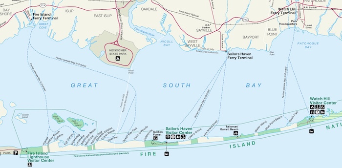
Fire Island Pines Historical Society — Sayville Ferry History.
1908 — Long Island Motor Parkway Constructed
Also known as Vanderbilt Parkway, Motor Parkway was the first road designed exclusively for automobiles. The first 10-mile portion, from Queens to Bethpage, was opened on October 10, 1908. Eventually, the roadway was extended to Lake Ronkonkoma and reached 45 miles in length.
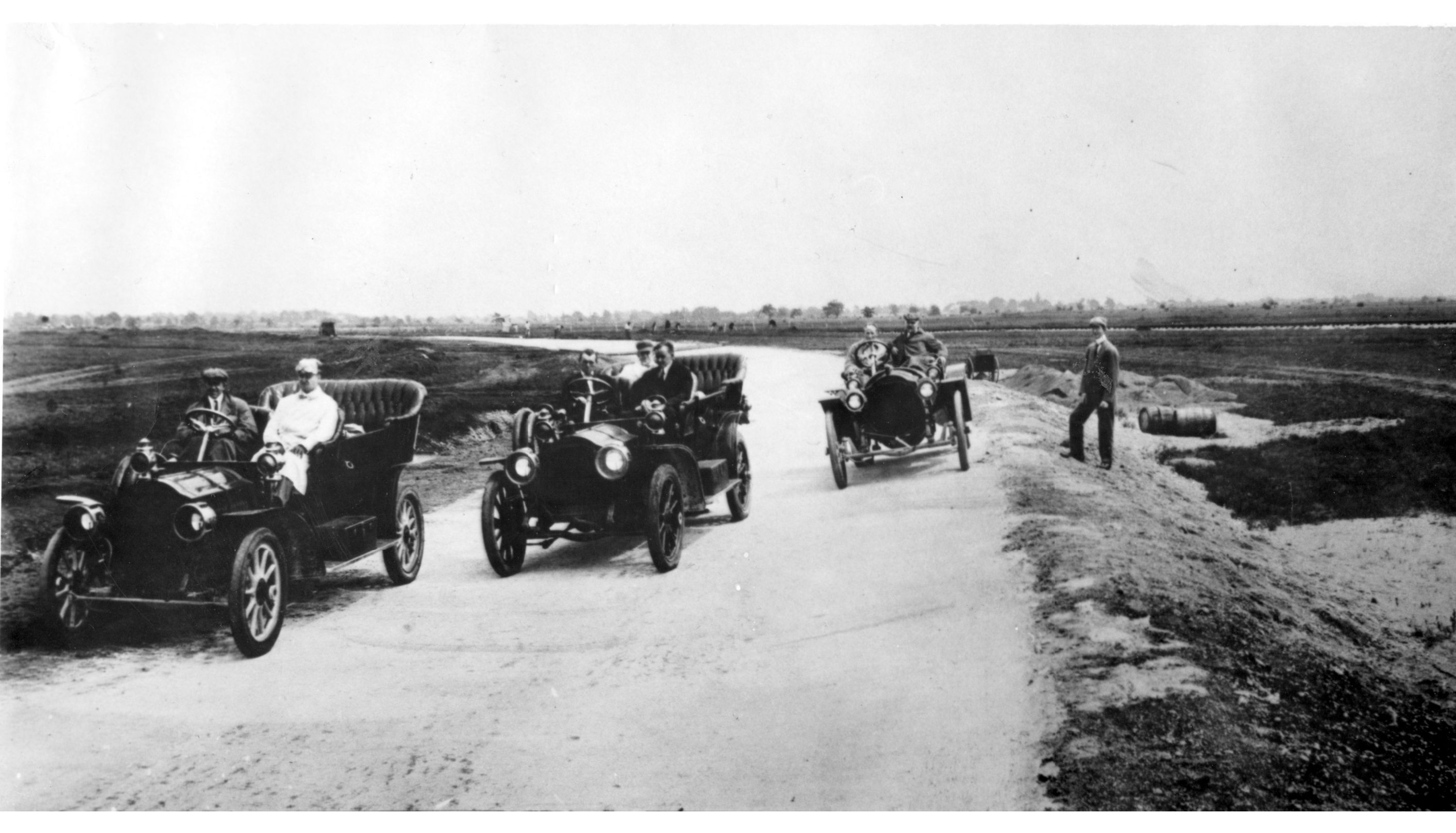
It was the first concrete highway in the United States and the world’s first limited-access highway. Overpasses and bridges were used to eliminate most intersections. Motor Parkway hosted auto races in its early years. Fatal accidents, however, led to state legislation banning auto racing except on designated racetracks.
More Details +
Also known as Vanderbilt Parkway, it was the first road designed exclusively for automobiles. The first portion completed was a 10-mile stretch from Queens to Bethpage. That was opened on October 10th, 1908. Eventually, the roadway was extended to Lake Ronkonkoma and reached 45 miles in length.
It was the first concrete highway in the U.S. and the world’s first limited-access highway. Overpasses and bridges were used to eliminate most intersections. Motor Parkway hosted auto races in its early years, but fatal accidents resulted in State Legislation banning auto racing except on racetracks.
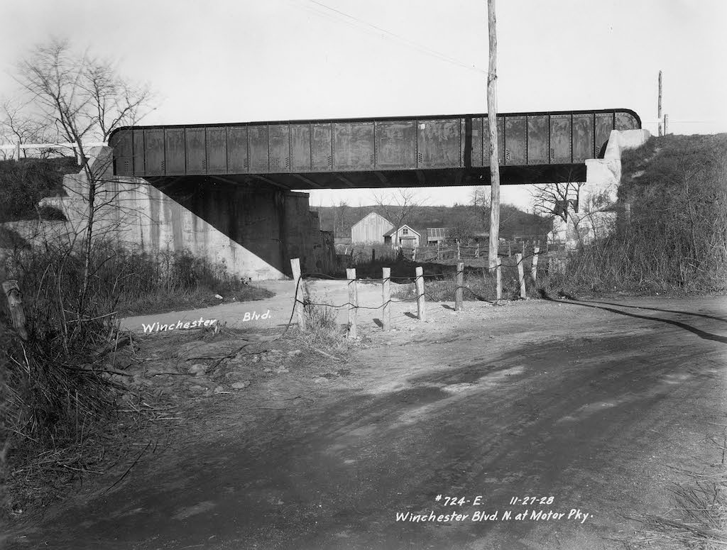
Motor Parkway was operated as a private toll road until it was closed and taken over by New York State for unpaid back taxes. The roadway still exists in places as parts of other roads and a bicycle and walking path.
1909— Powered Aircraft Flight Comes to Long Island
The Hempstead Plains were an ideal location for early aviation, as they were flat, treeless, and conveniently close to the population in New York City. In the early 20th century, Long Island became a major center for aviation, achieving several notable firsts. The region’s aviation history is showcased at the Cradle of Aviation Museum in Garden City, located on land that had been part of Mitchel Field, once a premier air base for the U.S. military.
1910 — Long Island Rail Road Service to Pennsylvania Station Begins
The Pennsylvania Railroad (PRR) acquired the Long Island Rail Road in 1900. PRR invested in improving rail connections to downtown Manhattan, leading to the construction of Pennsylvania Station, which became a central hub for both intercity rail and commuter rail. The LIRR was directly integrated into the station's infrastructure, with four tunnels built beneath the East River to connect Long Island to the new terminal.
The grand opening of Pennsylvania Station occurred in stages, with LIRR service beginning on September 8, 1910, and the full terminal opening on November 27, 1910. Direct access to Manhattan increased LIRR ridership to 34 million the following year.
Article: "The First LI Rail Road Trains Pull into Penn Station"
1911 — First Official Air Mail Flight in the U.S. and First Transcontinental Trip Across North America
The first official air mail flight in the United States took off in 1911 from an aviation meet held in Garden City. That same year, Cal Rodgers took off from Long Island in a Wright biplane to cross the United States. He ended his trip in California, 49 days later.
1918–1939 — The Golden Age of Aviation
After World War I, aviation transformed from a dangerous sport to a major industry. About 20 aircraft manufacturers were established on Long Island during this period, including Sikorsky, Sperry, Fairchild, Brewster, Columbia, Republic, and Grumman.
1919 — First Transatlantic Flight
A Navy Curtiss NC-4 flying boat, which had been built in Garden City, flew from Long Island to England, with two stops along the way.
1923 — First non-stop flight across the U.S.
The first non-stop flight across the United States took off in a Fokker T-2 triplane from Roosevelt Field on May 2, 1923. Two pilots, John Macready and Oakley Kelly, had only a compass and railroad maps to navigate. They landed at San Diego, almost 27 hours later.
1927 — Construction of Long Island State Parkways Begins
The Long Island parkway system was conceived by Robert Moses, commissioner of the Long Island State Parks Commission, from its establishment in 1924 until 1963. Long Island’s parkways were modeled after the Bronx River Parkway. The parkway system was designed to provide scenic and efficient access to state parks and beaches being developed on Long Island. The first section of the Southern State Parkway opened to the public in 1927. By the summer of 1929, Ocean Parkway and the Jones Beach Causeway were completed, providing direct access to Jones Beach.
More Details +
The parkway system was conceived by Robert Moses, a commissioner of the Long Island State Parks Commission from its establishment in 1924 until 1963. The Long Island parkways were modeled after the Bronx River Parkway, which was built between 1906 and 1925. Parkway construction on Long Island continued through the 1960s.
The parkway system was intended to create scenic, efficient access to the State Parks and beaches being developed on Long Island, which did not rely on increasingly congested and unattractive local roads. The first section of the Southern State Parkway was opened to public use in 1927. Ocean Parkway and the Jones Beach Causeway were opened, providing access to Jones Beach by the summer of 1929.
History of the Long Island Parkway System
Long Island Parkways Collection - Hofstra University (PDF)
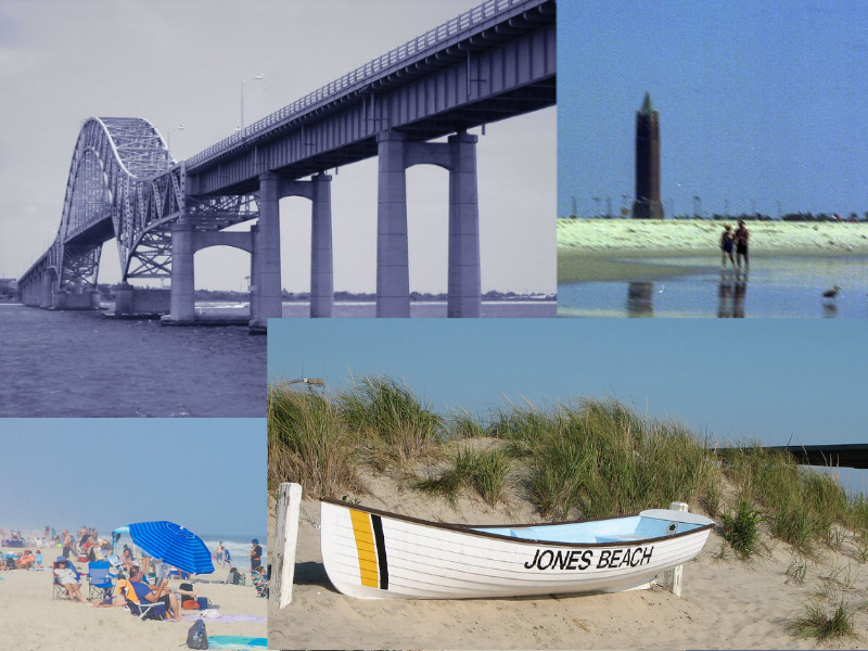
Photos credits: Robert Moses Causeway - Doug Kerr - CC BY-SA 2.0, Fire Island Needle - MFer Photography - CC BY-ND 2.0, Robert Moses Beach - Joe Shlabotnik - CC BY-NC-SA 2.0, Jones Beach Rescue boat - Neill Clenaghan - CC BY-NC-ND 2.0
Robert Moses changed the face of Long Island's roadway system. Here is a list of Long Island highways built under Moses' direction:
• Northern Parkway
• Southern Parkway
• Meadowbrook Parkway
• Wantagh Parkway
• Sagtikos Parkway
• Sunken Meadow Parkway
• Ocean Parkway
• Long Island Expressway
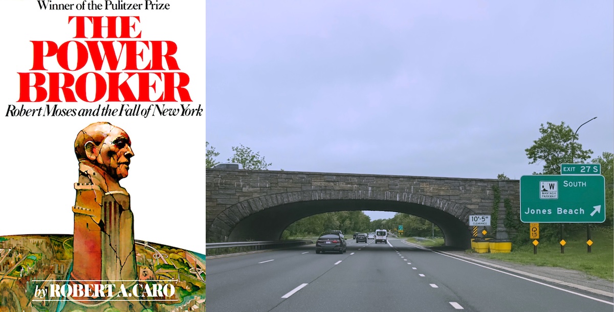
There have been strong criticisms of Moses’ autocratic approach, disregard for existing communities, and alleged racism and classism. Two particular examples involving Long Island’s parkways are recorded in Robert Caro’s biography of Moses, The Power Broker. The original route of the Northern State Parkway was changed to avoid a private golf course and a wealthy community that had the economic and political clout to fight back against Moses’ plans. The resulting change of route further south through the land of less influential farmers resulted in a curve in the roadway that was nicknamed “Objectors’ Bend”. Some claim that the bridges over the parkways were built too low for buses to drive under them at Moses’ direction, to keep the poor and minorities from easily accessing Long Island’s State beaches and parks.
1927 — Charles Lindbergh’s First Solo, Non-Stop, Transatlantic Flight.
On May 20, 1927, Charles Lindbergh took off from Roosevelt Field in his plane, the Spirit of St. Louis. Roosevelt Field had served as a training facility for the U.S. Army Air Service during World War I. By the 1930s, it had become the busiest commercial airfield in the United States.
Long Island's Roosevelt Field — Metropolitan Airport News
1938 — First Cross-Sound Bridge Proposal
Senator Royal S. Copeland, chair of the Senate Committee on Commerce during the 74th and 75th Congresses, proposed an 18-mile bridge from Orient Point to Groton, CT, or Watch Hill, RI. Engineering surveys began, but the project was abandoned after the death of Senator Copeland in 1938. Since then, at least nine projects or studies have been proposed for bridges or tunnels to cross the Long Island Sound. Proposed locations for the Long Island side have included Orient Point, Oyster Bay, Syosset, Kings Park, Port Jefferson, Wading River, Riverhead, and East Marion. Despite these proposals, the Throgs Neck Bridge, completed in 1961 and spanning the East River between Queens and the Bronx, is the easternmost connection to Long Island.
1939 — First Transatlantic Commercial Passenger Flight
On June 28, 1939, Pan Am carried the first 22 paying passengers to cross the Atlantic, flying from Port Washington to Lisbon, Portugal, aboard a Boeing Dixie Clipper flying boat.
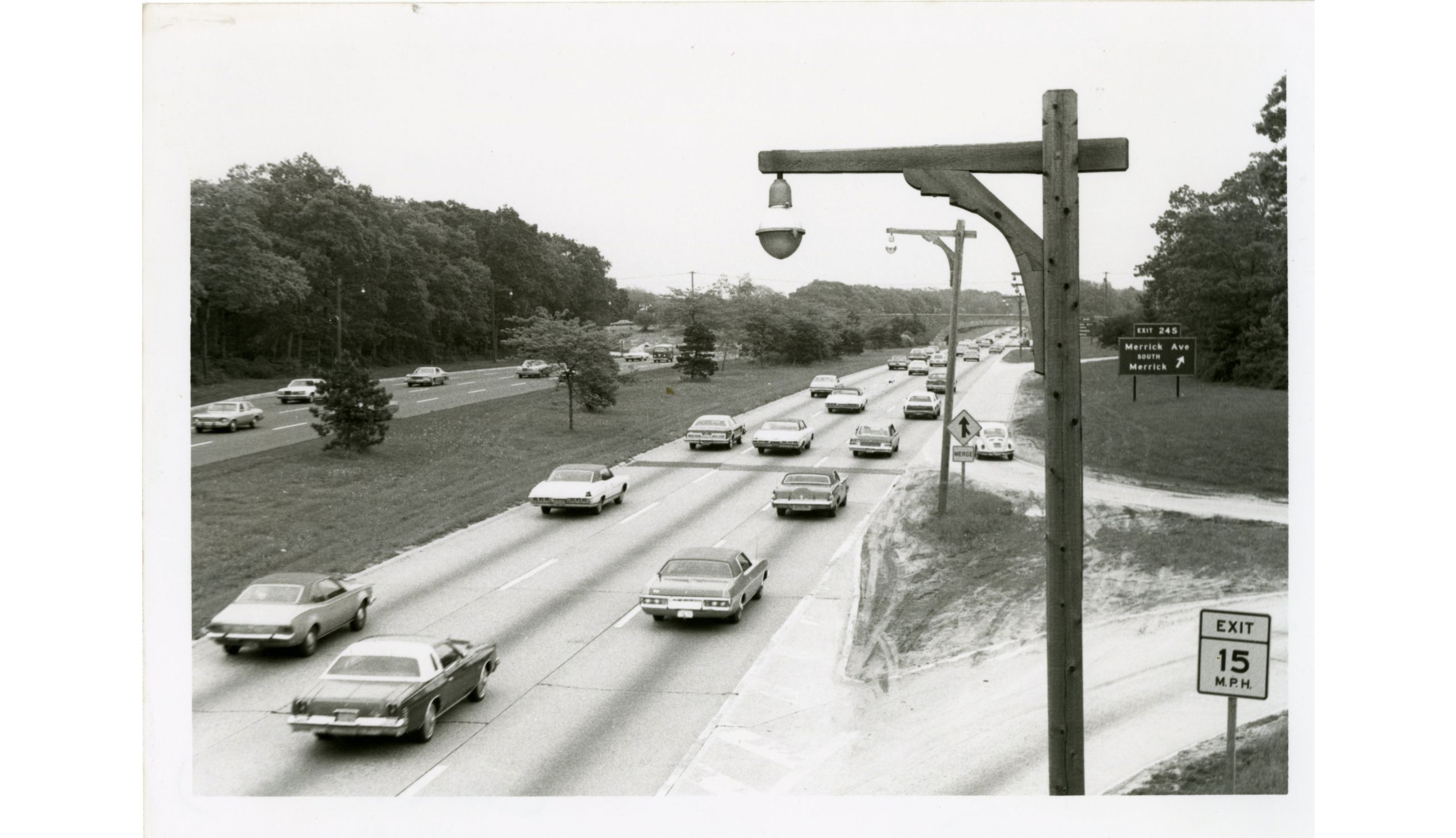
1939 — Long Island Expressway (LIE) Construction Begins
Work on the Long Island Expressway (LIE) began with the Queens–Midtown Tunnel. Construction continued until the highway reached Riverhead in 1972. Initially, Robert Moses, New York City’s arterial coordinator, argued that a highway connection to the tunnel was unnecessary. However, in 1945, after taking control of the New York City Tunnel Authority and forming the Triborough Bridge and Tunnel Authority (TBTA), Moses reversed his position and the TBTA funded an elevated highway extension.
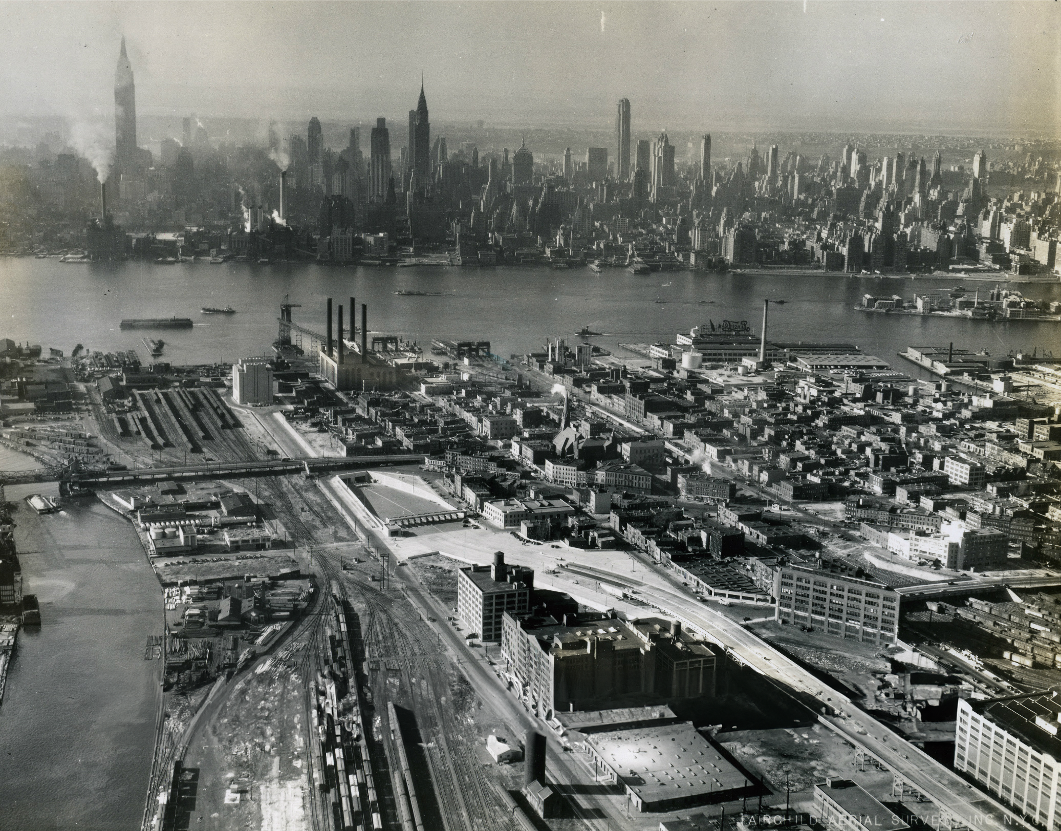
Robert Caro’s biography of Moses documents the master builder’s rush into construction in order to bypass studies of the feasibility of potential mass transit lines along the LIE’s right of way within the New York City limits. Plans for rail along the LIE right-of-way in Nassau and Suffolk counties were abandoned.
Long Island Expressway Historical Overview — nycroads.com
1945 — WWII Aircraft Industry Boom
Production of military aircraft became a major part of Long Island’s economy. By 1945, more than 100,000 people were employed in the aviation industry, with Grumman and Republic emerging as the predominant manufacturers. The aerospace industry continued to be a major employer into the 1980s. Grumman was Long Island’s largest employer for much of this time.
Post WWII — Autos Become Dominant
Even as the LIRR ridership continued to grow, development on Long Island became more and more focused on automobiles.
1948 — Fire Island Ferry
Fire Island Ferries began operating in 1948, providing a key transportation link between Long Island and Fire Island across the Great South Bay. Over the years, the agency expanded its operations and fleet, acquiring other ferry and water taxi services. In 1972, Edward J. Mooney acquired the company and guided its growth until his passing in 2020, making it Fire Island’s largest ferry company. Today, Fire Island Ferries, Inc. serves over 1 million people annually, operating eight routes and connecting various Fire Island communities, including Kismet, Ocean Beach, Saltaire, and Ocean Bay Park.
1952 — Sagtikos State Parkway Opens
The Sagtikos State Parkway officially opened in 1952, serving as a critical north-south connector on Long Island. The idea for the parkway dates back to the 1920s, with the goal of linking the Northern State Parkway to the Southern State Parkway. The Sagtikos Parkway was part of the Long Island Regional Park and Parkway Plan, spearheaded by Robert Moses, the influential planner behind much of the Island’s parkway system. The road was designed to connect with other major thoroughfares, including the Sunken Meadow State Parkway and Captree State Parkway, now the Robert Moses Causeway.
In 2012, it was designated a National Historic Parkway, recognizing its significance in Long Island’s transportation history.
More Details +
The Sagtikos State Parkway officially opened in 1952, serving as a critical north-south connector on Long Island. The idea for the parkway dates back to the 1920s, with the goal of linking the Northern State Parkway to the Southern State Parkway. To facilitate construction, the heirs of David Gardiner, the owner of the historic Sagtikos Manor, donated nearly 200 acres of land to the Long Island State Park Commission. Additional land was provided by James Fisher, a nearby resident, ensuring that the necessary right-of-way was available for the parkway's route.
The Sagtikos Parkway was part of the Long Island Regional Park and Parkway Plan, spearheaded by Robert Moses, the influential planner behind much of the island’s parkway system. The road was designed to connect with other major thoroughfares, including the Sunken Meadow State Parkway and Captree State Parkway (now the Robert Moses Causeway).
Construction was funded through a $3 million allocation in 1950, with paving contracts awarded in 1951. The parkway was completed and opened without major public celebration in 1952, but additional upgrades and connections led to its official designation as a completed route in 1958. Over the years, the Sagtikos Parkway has remained a vital transportation corridor, handling 90,000 vehicles per day in some sections. In 2012, it was designated a National Historic Parkway, recognizing its significance in Long Island’s transportation history.
To this day, the parkway continues to face challenges such as narrow shoulders, short acceleration lanes, and low clearance issues, prompting discussions on modernization while preserving its historic character.
Sagtikos State Parkway - History - Construction and Opening — liquisearch.com
Parkway Upgrade Needed for Improved N-S Travel — Long Island Regional Planning Council
1957 — Sunken Meadow Parkway Opens
The Sunken Meadow State Parkway was constructed as part of Robert Moses' vision for expanding access to Long Island’s parks. Sunken Meadow State Park was established in 1928, but it remained relatively inaccessible. By the 1950s, demand for better access to the park had grown, leading to the development of the Sunken Meadow Parkway as an extension of the Sagtikos State Parkway.
More Details +
The Sunken Meadow State Parkway was constructed as part of Robert Moses' vision for expanding access to Long Island’s parks. Initially, Sunken Meadow State Park was established in 1928, but it remained relatively inaccessible. By the 1950s, demand for better access to the park had grown, leading to the development of the Sunken Meadow Parkway as an extension of the Sagtikos State Parkway.
The first segment, a 2-mile stretch from the Northern State Parkway to Jericho Turnpike (NY 25), opened on November 29, 1954. The full 7-mile parkway was completed and opened to traffic on April 1, 1957, after an $11 million construction project. The parkway's opening led to a major expansion of Sunken Meadow State Park, which grew to 1,020 acres with additional parking facilities, a cafeteria, an extended boardwalk, and new recreational areas.
The Long Island Parks Commission predicted that Sunken Meadow would become the second most visited park on Long Island after Jones Beach. To accommodate this expected growth, four new parking lots were built, increasing capacity from 3,000 to 7,500 vehicles. The boardwalk was extended from 2,000 feet to 3,700 feet, and a scenic overlook with additional parking for 1,250 cars was constructed.
Sunken Meadow State Parkway — AARoads Wiki
1958 — First “Long Island” Section of the Long Island Expressway Opens in Nassau
In October 1958, the section of the LIE from Exit 32 (Little Neck Parkway) to Exit 39 (Glen Cove Road in East Hills) opened to the public. Robert Moses had secured land for the eastern expansion of the Expressway through Old Westbury. Planners, however, faced resistance from wealthy landowners along Nassau County’s North Shore, similar to the opposition Governor Alfred E. Smith encountered in 1929, which forced a two-mile diversion of the Northern State Parkway, dubbed “Objectors’ Bend.” As part of Moses’ agreement, interchanges were prohibited for a four-mile portion of the highway.
Long Island Expressway Historical Overview — nycroads.com
1960 — Long Island MacArthur Airport
Long Island MacArthur Airport (ISP), located in Ronkonkoma, New York, serves the central Long Island region. Originally built as a military airfield in 1942, it was converted to a commercial airport in 1960. ISP provides both general aviation and commercial airline services, with general aviation accounting for a significant portion of its operations.
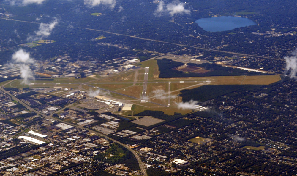
Photo credit: Eric Salard, CC BY-SA 2.0, via Wikimedia Commons
More Details +
Long Island MacArthur Airport (ISP), located in Ronkonkoma, New York, serves the central Long Island area. Originally built as a military airfield in 1942, it became a commercial airport in 1960. The airport is named after General Douglas MacArthur, who became famous for his escape from the Philippines during World War II. ISP offers both general aviation and commercial airline services, with a significant portion of operations being general aviation.
Photo credit: Eric Salard, CC BY-SA 2.0, via Wikimedia Commons
Over the years, the airport has seen growth, serving over 1.29 million passengers in 2017. It has been a key hub for regional flights, with carriers like Spirit Airlines, Southwest Airlines, and American Airlines offering flights to destinations like Orlando, Fort Lauderdale, and Chicago. The airport remains a vital transportation option for Long Island, providing services to both commercial and private aviation.
The History of Long Island MacArthur Airport — Northwestern Airlines blog
1965 — Metropolitan Commuter Transportation Authority Purchases the Long Island Rail Road
In 1965, the Metropolitan Commuter Transportation Authority (MCTA) was created by New York Governor Nelson Rockefeller in response to growing concerns about the financial struggles of regional transportation systems. It was set up to oversee and manage the Long Island Rail Road, which had been operating under bankruptcy protection for over a decade, as well as other commuter rail lines in the New York City metropolitan area. The MCTA expanded its scope, eventually absorbing the New York City Transit Authority, which operated subways and buses, and the Triborough Bridge and Tunnel Authority, which operated toll bridges and tunnels. This consolidation culminated in March 1968 when the MCTA was renamed the Metropolitan Transportation Authority (MTA) to reflect its broader responsibilities. The MTA continues to manage a wide range of transportation services in the New York metropolitan area, making it one of the largest public transportation providers in the world.
Metropolitan Transportation Authority — Wikipedia
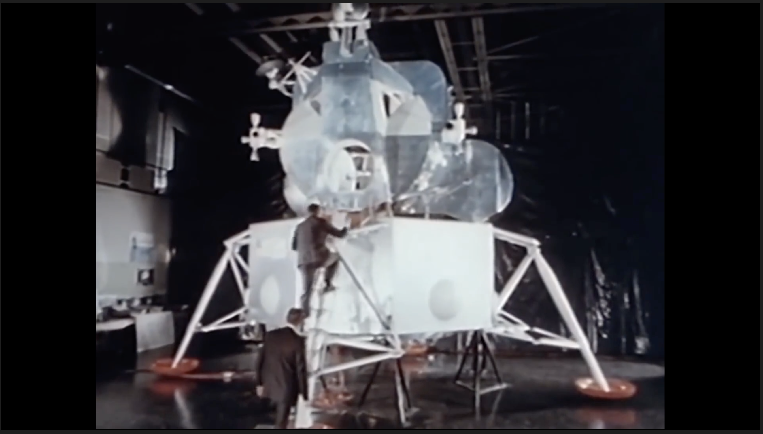
1969 — Moon Landing
On July 20, 1969, the Lunar Module Eagle, carrying Neil Armstrong and Buzz Aldrin, landed on the Moon. The Long Island-based Grumman Aerospace in Bethpage, which employed tens of thousands of Long Islanders, manufactured the NASA Lunar Module.
To the Moon: Grumman, the company that built Apollo 11's Lunar Module — ZDNET
1972 — Long Island Expressway Completed
The Long Island Expressway (LIE) was completed in segments, with its first section opening in 1940 as the Queens-Midtown Expressway. By the 1960s, it had expanded into a major route connecting Queens to Nassau and Suffolk counties. Spearheaded by Robert Moses and the Triborough Bridge and Tunnel Authority, the LIE was designed to alleviate worsening traffic congestion and accommodate growing commercial traffic on Long Island. The Long Island Expressway (LIE) reached Riverhead on June 28, 1972. The highway, originally designed to handle 80,000 vehicles daily, now sees over 200,000 in some areas.
Long Island Expressway (LIE) Facts and History — longisland.com
Long Island Expressway — NYC Parks
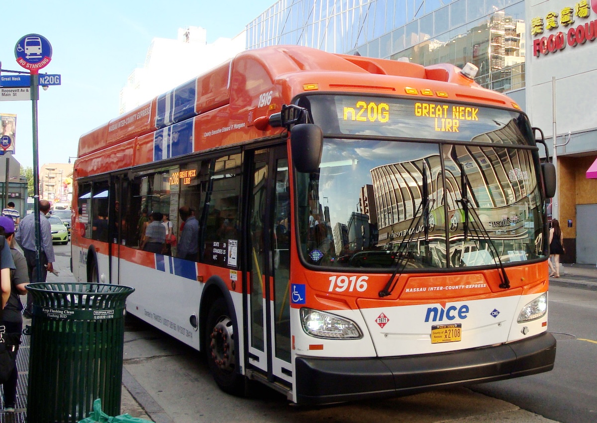
1973 — Metropolitan Suburban Bus Authority
In 1973, Nassau County assumed control of the Metropolitan Suburban Bus Authority’s operations in the county, acquiring assets from private transit companies and partnering with the Metropolitan Transportation Authority (MTA). This partnership led to the formal creation of the Metropolitan Suburban Bus Authority (MSBA), an MTA subsidiary. While Nassau County was responsible for funding the operations and capital expenses, the MTA handled the management of the system. In the late 1990s, the MSBA became known as MTA Long Island Bus, as part of a broader MTA rebranding. By 2012, due to financial disputes, Nassau County transitioned to a new operator and the system became part of Nassau Inter-County Express (NICE), operated by Transdev.
Nassau Inter-County Express — Wikipedia
MTA Long Island Bus — CPTDB Wiki
1974 — Hampton Jitney
The concept of the Hampton Jitney was born in 1973 during the energy crisis, sparked by the Arab oil embargo and a gasoline shortage. Jim Davidson, a young entrepreneur from Water Mill, initially envisioned a service using bicycles and small vans to help people get around the Hamptons without relying on cars. In 1975, he launched a regular minivan service between the Hamptons and New York City. The service proved successful, prompting the addition of a second van to meet growing demand. Over the years, Hampton Jitney expanded from small vans to larger motor coaches, providing a luxurious and reliable way to travel between the Hamptons and New York City.
1977 — Jones Beach Bicycle Path
The Jones Beach Bicycle Path, built in 1977, is a scenic and popular route along the southern shore of Long Island. This path stretches up to 10 miles and offers cyclists stunning views of the Great South Bay and the Atlantic Ocean. It is designed with a variety of surfaces, including paved paths and boardwalks, providing a safe ride for cyclists. Between 1977 and 2021, the multi-use path network was expanded. It now includes the Ellen Farrant Memorial Bikeway, which runs along Wantaugh Parkway from Cedar Creek County Park to Jones Beach, the Ocean Parkway Coastal Greenway, which connects to Captree State Park at the east end of Jone Beach Island, the Jones Beach State Park Boardwalk, and the Jones Beach Shared-Use Path, which reaches the west end of Jones Beach.
About the Jones Beach Bike Path
1980 — Suffolk County Transit
Suffolk County Transit, formed by the Suffolk County Legislature as a consolidation of several bus routes operated by private companies, began operation in 1980.
The system provides critical transportation services throughout Suffolk County, including suburban routes serving residents traveling to work, shopping, or other activities. Many of these buses are equipped with the latest technology for energy efficiency and passenger comfort. The transit system continues to evolve, as it updates its fleet and services in response to growing community needs and environmental concerns.
Suffolk County Transit Wiki
1991 — LIE High Occupancy Vehicle (HOV) Lane
Construction begins on the Long Island Expressway High Occupancy Vehicle (HOV) Lane, the first suburban HOV system in New York. The lane is restricted to motorcycles and vehicles with more than one occupant during rush hours.
2005 — LIE HOV Completed
The Long Island Expressway High Occupancy Vehicle (HOV) lanes opened in May 1994 and expanded more than 30 miles to Medford by 2005. Developed to combat traffic congestion and reduce fuel consumption, the lanes were intended to encourage carpooling. Studies have found the system provides a quicker commute during rush hour for those who can use it; however, census data does not indicate carpooling has increased as a result.
Long Island Expressway Historical Overview
2006 — Clean Pass
In 2006, the state of New York initiated the Clean Pass program, allowing eligible low-emission and ultra-low-emission vehicles to use the HOV lane on the Long Island Expressway (LIE), even with just one occupant. This pilot program aimed to promote the adoption of fuel-efficient vehicles and reduce emissions. It was projected to save 6,000 tons of greenhouse gases and over 500,000 gallons of gasoline annually. Eligible vehicles at the time included hybrids like the Toyota Prius and Honda Civic Hybrid, but the list expanded as more and more automobile manufacturers offered additional qualifying vehicle options. The program was initially evaluated for effectiveness before permanent implementation. The program ended as of October 1st, 2025, when the federal legislative authorization enabling it expired.
Former Senator John Flanagan Announces Environmental Use of HOV Lane
2011 — MTA Tax & Complete Streets Act
The Metropolitan Commuter Transportation Mobility Tax (MCTMT), also known as the MTA tax, is imposed on certain employers and self-employed individuals engaging in business within the metropolitan commuter transportation district. The tax proved highly unpopular, particularly in the suburban counties surrounding New York City however legislative efforts to repeal it have not succeeded.
The Complete Streets Act was signed into law in New York State on August 15, 2011. It requires state, county, and local agencies to consider the convenience and mobility of all users of streets, including pedestrians, bicyclists, people with disabilities, etc., when developing transportation projects that receive state and federal funding.
2012 — NICE Bus
After years of funding disagreements with the MTA, in 2012, Nassau County replaced the MTA-run Long Island Bus with the Nassau Inter-County Express (NICE), switching operations to a private contractor.
2013 — Ocean Beach Parkway Rebuilt
In 2013, Ocean Parkway, which runs most of the length of Jones Beach Island, was fully rebuilt after suffering catastrophic damage from Superstorm Sandy in October 2012.
2016 — LI Welcome Center Opens
On October 20, 2016, the LI Welcome Center opened as a 15,200-square-foot, LEED-certified facility on the eastbound LIE between exits 51 and 52. Operated in partnership with Cornell Cooperative Extension of Nassau County, it features a Taste NY Market, tourism information, a playground, electric car charging stations, an animal comfort area, and a Long Island "Walk of Fame."
Long Island Welcome Center website
2017 — LI Sound Crossing Feasibility Study
The purpose of the LI Sound Crossing Feasibility Study, completed in December 2017, was to perform a high-level feasibility analysis to understand and identify if a Long Island Sound crossing from the northern shore of Long Island to the northern shore of the Sound could improve the region’s overall transportation network. Study goals included: (1) Improve regional mobility and connectivity; (2) Promote economic growth; (3) Minimize adverse environmental impacts; and (4) Develop cost-effective transportation options.
Feasibility Study - NY Department of Transportation
2018 — Long Island Rail Road Double Track Project
The Long Island Rail Road (LIRR) Double Track project, completed in 2018, added a second track along a 13-mile stretch between Farmingdale and Ronkonkoma and carries 48,000 riders a day. This expansion improved service reliability, increased train frequency, and supported economic growth on Long Island. The project, which cost approximately $387.2 million, was a key part of broader MTA infrastructure improvements, helping reduce delays and congestion, and allowing for reverse-peak service expansions on the busy corridor.
ABC7 News article on the completion of the project.
2021 — Ocean Parkway Coastal Greenway
Ocean Parkway Coastal Greenway is an ADA-compliant, shared-use bike and multi-use path. As of 2021, it is now a continuous path between Jones Beach State Park and Captree State Park. It allows users to enjoy ocean views, amenities like restrooms and food concessions, and a safety barrier from the adjacent parkway. (See 1977 — Jones Beach Bicycle Path.)
2022 — LIRR Third Track
On October 3, 2022, the third track for the LIRR main line was completed between Mineola and Hicksville. The additional track improves frequency of service, reliability, and reverse commuting.
MTA information on the project.
2023 — East Side Access completed
The new Grand Central Madison station opened on January 25, 2023. This extension of the Long Island Railroad’s main line provides a second terminal in Manhattan for Long Island commuters, removing a subway transfer for many.
Digging of the 63rd Street Tunnel, a double-deck tunnel that is used by both for LIRR East Side Access and subways, began in 1969, but was halted due to New York City’s fiscal crisis of 1975. Subway service on the upper deck began in 1989. Construction on the lower deck for LIRR East Side Access resumed in 2007.
Recent LIRR infrastructure improvements, including East Side Access, the Main Line Third Track, and the Ronkonkoma Line Double Track, have allowed for a 41% service increase with more trains running during peak hours and better reverse commuting options to Long Island.
Summary and Analysis
Long Island’s history shows that infrastructure built for a particular purpose often produces unintended consequences and is frequently repurposed to meet new needs. For example, the Long Island Rail Road was originally established to shorten travel times from New York City to Boston, but it evolved into a busy commuter rail system, transporting Long Islanders to jobs in New York City. Similarly, the Long Island Motor Parkway, the world’s first limited-access highway, was originally built for wealthy automobile enthusiasts to drive and race without interference from local traffic. Today, the remaining sections serve as heavily trafficked thoroughfares or have been converted into bike and walking paths. State parkways were originally designed to allow New York City residents to take leisurely drives to parks and beaches, providing an escape from the city and an opportunity to enjoy nature. Although intended for recreation, these parkways and expressways have since become major commuter routes, contributing to suburban sprawl and chronic traffic congestion.
The region’s early embrace of the automobile helped shape the layout of modern suburbs. Infrastructure decisions made decades ago now restrict options for mobility and sustainability. As public demand grows for more reliable mass transit, safer bike and pedestrian networks, and reduced traffic congestion, Long Island must confront how its transportation legacy affects everything from economic access to climate resiliency. Revisiting lessons of the past will help guide future investments and foster a more connected, equitable, and forward-thinking transportation system for the next generation.